02/10-08/10 Flinders Ranges.
When we arrived at the Wilpena Pound resort it was a very hot dusty and windy day, so apart from checking out the resort we relaxed. Late in the afternoon the cool change came through and it was a pretty wild night. The lighting lit up the sky. The thunderstorms continued to roll during the night and into the morning with gusty winds and some rain. At least the rain has settled the dust.
.jpg) |
| Wilpena Resort. |
Tuesday morning was a lot cooler and after doing a few jobs around the caravan we set off on the walk to Hills Homestead and the Wangarra lookout, When we started out it was nice and quiet with a few families returning from the walk, we managed to see a Yellow Footed Rock Wallaby having lunch under the gum trees. We were a bit slow going photographing the wildflowers as we went, groups of families were catching us up and it turned out to be busier than Bourke Street Mall at Christmas. We made it to the homestead and then climbed the track to the Wangarra lookouts which give spectacular views of Wilpena Pound and the surrounding rocky hills. On the way back to camp we stopped in at the resort bar for a drink and got involved with the Welcome to Country smoking ceremony. It was really interesting as we had never been to a smoking ceremony before. The native hop plant that was used to make the smoke smelt quite nice, much better than wood smoke.
.jpg) |
| Hills Homestead |
.jpg) |
| Blueberry Lily? |
.jpg) |
| Wilpena Pound. |
Returning to camp we couldn't believe our eyes, our quiet campsite had been invaded by a school group. Two bus loads, about 90 kids, teachers, bus drivers, and support people. They took over two camp kitchens and a fair bit of real estate. Ken got chatting with one of the bus drivers and he said they are on a trek in the outback as part of their VCE curriculum for the past couple of weeks. They are from Nowra in NSW.
 |
| The Invaders. |
Overnight we had heaps of rain over 15mm recorded at Rawnsley Station. We woke up to a pretty damp site. The forecast for the day was cold and showery. We decided we would do the Mt Ohlsson-Bagge walk. A walk of 2.7km upwards. We started out around 11am and walked up most of the way but about 1.5km from the top it started to rain which did clear in about 10-15 mins, the next section was rock climbing and slippery. With more showers coming Linda didn't want to go any further as she was a bit nervous. We turned around and headed back down to camp.
.jpg) |
| Mt Ohlsson-Bagge. |
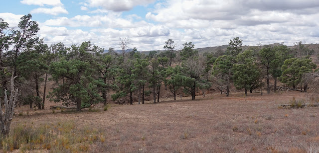
Thursday dawned a much brighter day, the school group had headed off at about 5:30 am to their next destination so the campground was quiet again. We then left as well and headed to our next campsite in the Flinders Ranges at Trezona. The landscape has changed the forest has gone and it's back to salt bush. Our campsite is situated on Enorama Creek which is dry at the moment. There are some beautiful gum trees lining the creek and it's nice and quiet except for the baby magpies. After lunch, we hopped on the bikes and rode into Brachina Gorge. It was a truly fantastic place the geology is so varied as you ride along. We rode 12 km to the end stopping on the way to admire the rock formations and on the way back we stopped off at the place where the yellow-footed rock wallabies hang out. We managed to see at least 5 or 6 hopping around and having a great old time.
.jpg) |
| Enorama Creek |
.jpg) |
| Ride to Brachina Gorge |
.jpg) |
| Brachina Gorge |
.jpg) |
| Brachina Gorge |
.jpg) |
| Brachina Gorge |
It was a mild night and we relaxed around camp with a glass port stargazing and counting satellites as they zoomed past.
The next day we did a hike around the Trezona circuit. It's an 8.2km walk which highlights the geology of the area. The first thing of interest is the Golden Spike, a brass disk that marks the point where different periods of rock have been laid down over millions of years. We continued along Enorama Creek, there are a couple of creek crossings before the trail takes you along the creek to the Stromatolites, these are rocks that have the imprint of Cyanobacteria remaining on the rocks in a circular pattern. They are the earliest forms of life and were able to release the oxygen bound up in the chemical molecules into the atmosphere.
.jpg) |
| Multicolour river pebbles. |
.jpg) |
| Stromatolites |
After leaving the creek we head for the ruins of an old shepherd's hut that was used by shepherds that were herding the sheep when Aroona Valley was a sheep station back in the 1850's and 60's. From here we travel across the undulating plains which are covered in Elegant Wattle these are all in bloom at the moment and there are also patches of wildflowers still showing. The wildflowers in this area are all out at different times some have finished and some are still waiting to bloom.
.jpg) |
| Elegant Wattle |
.jpg) |
| Cypress Pine |
.jpg) |
| Mum and the Kids. |
Along this walk, there are great views of the Heysen Range with the dark red rocks lining the range. We came across another hut, the Elatina Hut which is near spring, the original hut here was built in the 1930's but it's been replaced by a brick hut and is used by hikers walking the Heysen trail. We try not to stop for too long as the flies are driving us mad. There are millions of them. We finish our walk back to the campground and a cool wind has started. time to relax.
 |
| Heysen Range |
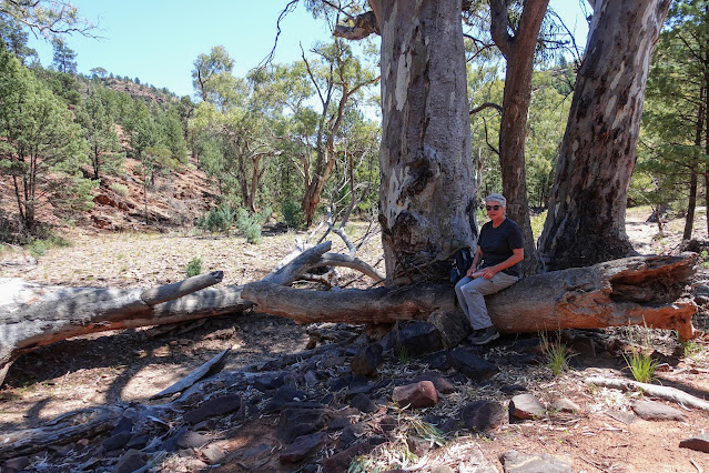
The next morning we head about 20 minutes up the track to our next campsite, Aroona, another beautiful spot in the Aroona Valley next to the Aroona Creek which is lined with old river red gums. In the distance is Eddie Pumpa's homestead built in 1925 of pine and pug which has been preserved by SA National Parks, Hans Heysen the artist stayed here on some of his painting expeditions, and up on the hill are the ruins of the old homestead built by Frederick Haywood who arrived in 1851 and occupied the area for 11 years, the property was called the Aroona Run. We are surrounded by the Heysen Range and the ABC Range.
.jpg) |
| ABC Range. |
.jpg) |
| Aroona Creek - Heysen Range |
.jpg) |
| Eddie Pumpa's homestead. |
We are here in Aroona to do the Yuluna Walk which is 8.4km's and starts at Eddie Pumpas Homestead. On a beautiful Sunday morning, we headed off at around 10:30 a.m. The walk mainly takes you through White Cypress Pine woodland the first 4kms there aren't any wildflowers. The walks along the dry creek beds are quite beautiful with interesting geology. After coming across an old stone cairn we diverted to a ruin of another old Shepherds hut called Bendowta (there wasn't much left of it) we headed uphill along an old bridle track used by the shepherds. It was a well-wooded area of mainly white cypress pine with the remains of little yellow daisies covering the slopes. A month ago the area must have been covered in tiny wildflowers that have now finished flowering.
%20(25).jpg) |
| Yuluna Walk |
%20(22).jpg) |
| Lunch break. |
The trail eventually heads down again into Yuluna Creek and then up a very narrow track that crisscrosses along the ridges of the surrounding hills. In some sections, you could stand in the middle of a dry waterfall and view where it spills into the creek below. The slopes are very rocky and plants just hang on between the rocky outcrops, there were native hop bush and jockey cap flowers still showing along the trail, and the remains of tiny billy buttons are on display. This was the best part of the walk as the views were also spectacular. As we got to the end of the walk there was a track heading off to Heysens Viewpoint where Hans Heysen used to relax with a glass of beer in the evening and take in the view of the Aroona Valley. We climbed to the top of the spur and the views were truly magnificent.
%20(42).jpg) |
| The three sisters. |
%20(46).jpg) |
| Heysen Range. |
09/10-10/10 - Copely/Leigh Creek
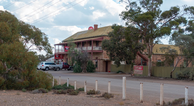
We left Aroona and the Flinders Ranges and headed for our next destination, Leigh Creek and Copley. The journey took us via Blinman another old mining town where mining has ceased but there are enough residents there to keep the town going. It has some great old stone buildings, a grand old pub with a campsite out the back, a post office, and a bakery.
.jpg) |
| Blinman |
From Blinman we head along a bumpy dirt road through the winding hills and along Parachilina Gorge where we saw lots of campsites set up along the dry creek bed in the gorge. Once you leave the gorge the road becomes dead straight the trees disappear and the flat saltbush plains appear. The landscape changes colour as we drive along with masses of yellow flowers spread among the saltbush. We then set up in the caravan park at Cropley which is about 5km's from Leigh Creek. The taps in the campground are covered with wheelie bins as the horses roam around the town and they have worked out how to turn on the taps. There's a parrot living in one of the dongas here that chats away throughout the day and a little brown dog that lives on the other side of town and seems to spend a lot of its time in the caravan park visiting the campers. As we don't have a dog with us She made herself at home.
 |
| They just wander around town. |
.jpg) |
| Copley servo |
.jpg) |
| Copley Pub |
 |
| Our temporary dog. (Socks) |
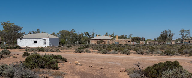
We decided to stay in Copley for two nights as there is plenty to see around this area. Today we headed out to Beltana a historic mining town that is a state heritage town. Beltana is where camels were first brought into Australia, where the Royal Flying Doctor Service began and pedal wireless experiments took place. The area was settled originally by pastoralists in the 1850's and 60's and the town was surveyed in 1873. People brought plots of land there and the town sprung up supporting the copper and silver mining industries which commenced around 1870. Many of the buildings are still there although they are privately owned but you can walk around the town and take pictures of them. Most have an information board letting you know what they are.
.jpg) |
| Beltana |
.jpg) |
| Beltana |
.jpg) |
| Beltana |
When we left Belatna we took the 4WD route back to the highway which follows the old Beltana Railway line, again we came across some fantastic views of the rocky surrounding the area. Our next stop was the Aroona Dam. The dam was originally a water hole, the coal mining company that was mining at Leigh Creek then dammed the water hole so that they had a water supply. The mine closed in 2015 and now the dam is used for recreational purposes. They have introduced Murray Cod, Golden Perch, and turtles. When we were at the dam wall there were about 15 or 20 Turtles sunbaking on the surface of the water with the fish swimming underneath them.
.jpg) |
| One of the many Lizards. |
.jpg) |
| Aroona Dam. |
Next StopArkaroola.
.jpg)
.jpg)
.jpg)
.jpg)
.jpg)
.jpg)
.jpg)

.jpg)
.jpg)
.jpg)
.jpg)
.jpg)
.jpg)
.jpg)
.jpg)

.jpg)
.jpg)
.jpg)
.jpg)
.jpg)
.jpg)
.jpg)
.jpg)

.jpg)
-2.jpg)
.jpg)
.jpg)
.jpg)
%20(25).jpg)
%20(20).jpg)
%20(22).jpg)
%20(42).jpg)
%20(46).jpg)
.jpg)
.jpg)

.jpg)
.jpg)

.jpg)
.jpg)
.jpg)
.jpg)
.jpg)
.jpg)
.jpg)
Comments